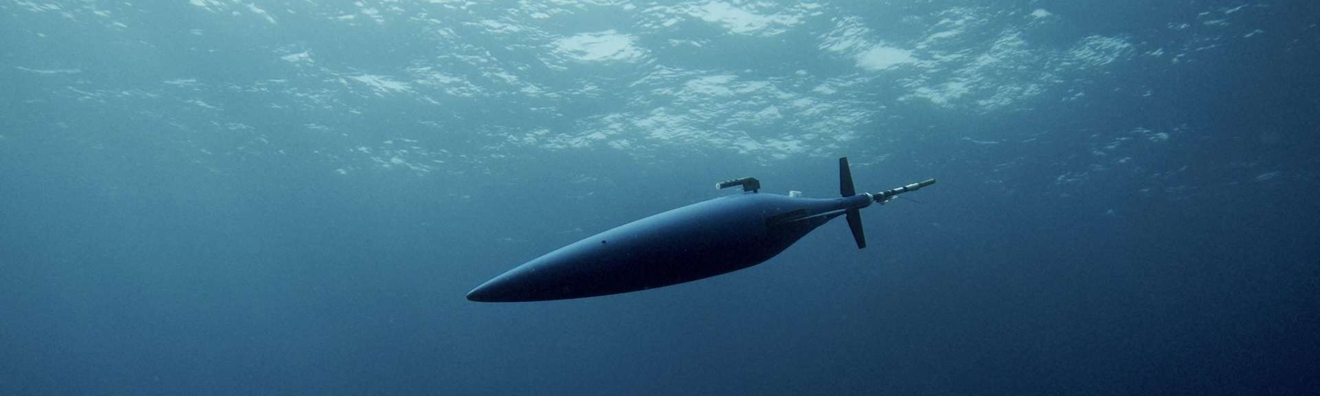
The main vehicles for making this a reality are a class of underwater vehicles called "gliders": without any propulsion system, they progress through the oceans like ludions, simply varying their buoyancy by means of a pump that modifies the volume and an ingenious battery displacement system that changes the weight distribution. The various fins on the surface of the gliders do the rest, so that they glide down as well as up.
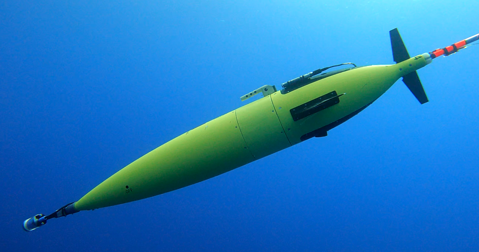
Gliders move noiselessly and emit no pollution, so they have no impact on ecosystems. As they are not dependent on fuel, they can stay at sea for months at a time, collecting invaluable data that is transmitted to land by satellite in almost real time, as Laurent Mortier, Professor of Oceanography at ENSTA Paris and a researcher in the Mechanical Engineering Department, confirms: "They are capable of taking measurements of temperature, salinity, nitrate concentration, underwater noise, zooplankton imagery, etc. It all depends on the sensors they are fitted with, as long as they are energy-efficient."
The only limit is the energy available on board, the equivalent in joules of two chocolate bars, on which all the systems have to live for several months, the current record being one year. "So not all the sensors can work at the same time," continues the oceanographer. "Beyond the scientific measurement, which is its raison d'être, this energy has to be distributed between the navigation and communication systems."
In extreme conditions, such as under the ice of the Arctic Ocean where there is no satellite link, particularly robust communication systems need to be developed, capable of operating under water, because the whole point of the data collected by the gliders is to be transmitted in near-real time. This is the speciality of Benoit Geller, professor and researcher at the Computer Science and Systems Engineering Department at ENSTA Paris:
"Radio radiation propagates very poorly in water, so we use acoustic waves. Their bandwidth is very limited compared with radio waves. What's more, the wave dissipates very quickly, and its speed is much lower than that of radio waves, which means that data rates are very slow, at less than ten kilobytes per second. Very sophisticated processing is therefore required to improve throughput. And because gliders are so energy constrained, communication systems are switched off 99% of the time."
Equipped in this way, the gliders can be deployed in all the areas of interest to scientists. "Eddies are particularly interesting places for us, and we're trying to understand the associated oceanic phenomena," continues Laurent Mortier.
One of the favourite areas for French researchers is the Mediterranean sea, with two radials occupied by gliders for a large part of the year, Nice-Calvi and Marseille-Minorca, which enable the information from the gliders to be cross-checked with that collected by oceanographic vessels or moored buoys.
The second type of observation carried out with the gliders is operational oceanography. "In order to feed the models that predict the state of the ocean, we need recurrent observations, carried out as regularly as possible. Gliders are excellent instruments for this," confirms Laurent Mortier.
Finally, gliders also have environmental applications in detecting pollution around industrial installations such as oil rigs, or assessing the impact of offshore wind farms. As environmental monitoring over long periods, for example in marine protected areas, gradually develops, the use of gliders is set to become commonplace.
"But the real challenge for us today is to centralise the data and make it available to as many users as possible, so that it can be used simply and cost-effectively," explains Laurent Mortier. This is precisely the ambition of GROOM II, an acronym for "Gliders for Research, Ocean Observations and Management Research: Infrastructure and Innovation", a European Horizon 2020 project coordinated by Laurent Mortier.
"We want to set up the same kind of organisation for gliders and their oceanographic sensors as exists for weather data," explains Laurent Mortier. "The idea is for data management to be centralised, with a few main centres offering users the resources for processing and disseminating the data, while guaranteeing its quality. At European level, we have already succeeded in setting up such a structure with the help of Ifremer, with data processed and disseminated usually in less than 6 hours. We could also optimise and automate the piloting of gliders at European level, one of the most costly areas in terms of human resources. We want to demonstrate to the European institutions that the added value of networking is to reduce the workload and ultimately the cost, while ensuring that the quality of the research we carry out is of the highest standard in the world."
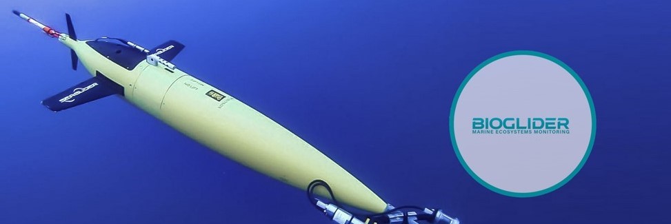
Laurent Mortier's dream is to set up a European network of 400 gliders. "Thanks to their silent evolution and absence of pollution, gliders would be extraordinary tools for the continuous study of marine ecosystems on the scale of all European seas and beyond. We have a pilot project along these lines, Bioglider, for the observation of zooplankton ecosystems, in which we are truly pioneers on a global scale," enthuses the oceanographer.
But Laurent Mortier sees even further ahead, in other words, deeper down. "Observing and understanding the role of the deep ocean is a key parameter in the various global warming scenarios. It is the only place where the oceans will still accumulate heat. Going to the bottom of the oceans with gliders is also a systematic and inexpensive way of studying underwater volcanism or assessing the impact of extractive activities that seem to be on the horizon, in particular mineral exploitation, despite warnings from scientists and proposed moratoria".
These are some of the issues at stake in France 2030's "Deep Seabed" objective, announced in February 2022 and backed by €300 million of investment. With the world's second largest exclusive economic zone, and with most of the world's digital communications passing through undersea cables, having the means to monitor and intervene in the seabed is also an absolute imperative of sovereignty.
What role will gliders play in this strategy? Being able to descend autonomously to a depth of 6,000 metres at low cost would make it possible to explore a large part of the seabed that is inaccessible today. "These depths represent a major challenge," confirms Laurent Mortier. "But the technical challenges of achieving this with gliders are enormous: we need a hull that is as light as possible, with a compressibility close to that of seawater, to evolve with the minimum of energy, while being able to withstand the immense pressure prevailing at the bottom of the oceans. It's a great engineering challenge. But for the moment, while it's undoubtedly within our grasp, it's yet to be achieved."